
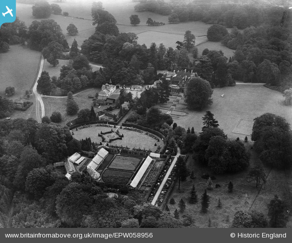
EPW058956 ENGLAND (1938). Shabden Park, Chipstead, 1938
© Copyright OpenStreetMap contributors and licensed by the OpenStreetMap Foundation. 2025. Cartography is licensed as CC BY-SA.
Nearby Images (5)
EPW058956

EPW036655

EPW036654

EPW058955

EPW036938

Details
| Title | [EPW058956] Shabden Park, Chipstead, 1938 |
| Reference | EPW058956 |
| Date | 30-August-1938 |
| Link | |
| Place name | CHIPSTEAD |
| Parish | |
| District | |
| Country | ENGLAND |
| Easting / Northing | 527448, 156157 |
| Longitude / Latitude | -0.17206476824537, 51.289759003111 |
| National Grid Reference | TQ274562 |
Pins
Be the first to add a comment to this image!