
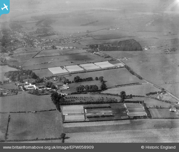
EPW058909 ENGLAND (1938). The Ashwell Gardens Nurseries, Mere, from the east, 1938
© Copyright OpenStreetMap contributors and licensed by the OpenStreetMap Foundation. 2026. Cartography is licensed as CC BY-SA.
Nearby Images (8)
EPW058909

EPW058906

EPW058907

EPW059017

EPW059018

EPW059016

EPW059020

EPW059019

Details
| Title | [EPW058909] The Ashwell Gardens Nurseries, Mere, from the east, 1938 |
| Reference | EPW058909 |
| Date | 26-August-1938 |
| Link | |
| Place name | MERE |
| Parish | MERE |
| District | |
| Country | ENGLAND |
| Easting / Northing | 382675, 132661 |
| Longitude / Latitude | -2.2474177410006, 51.092466767103 |
| National Grid Reference | ST827327 |
Pins

martynrb |
Saturday 15th of November 2025 01:58:14 PM | |
|
martynrb |
Saturday 15th of November 2025 01:57:46 PM | |
|
martynrb |
Saturday 15th of November 2025 01:57:03 PM | |
|
martynrb |
Saturday 15th of November 2025 01:55:14 PM | |

Class31 |
Tuesday 13th of August 2013 11:44:53 AM | |
|
Class31 |
Tuesday 13th of August 2013 11:32:12 AM | |
|
Class31 |
Monday 12th of August 2013 01:41:32 PM |