
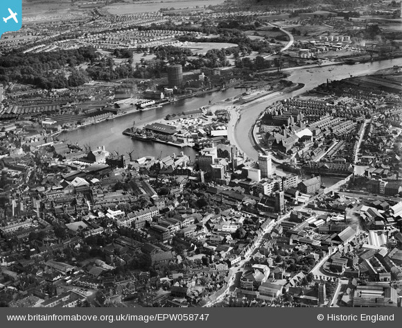
EPW058747 ENGLAND (1938). Wet Dock, New Cut and environs, Ipswich, 1938
© Copyright OpenStreetMap contributors and licensed by the OpenStreetMap Foundation. 2026. Cartography is licensed as CC BY-SA.
Nearby Images (19)
EPW058747

EPW041352

EPW041351

EPW041353

EPW041350

EPW005253

EAW053511

EPW032832

EPW032873

EPW058767
 Ltd timber works, Three Cranes Wharf and New Cut East, Ipswich, 1938")
EPW058746

EPW032845

EPW058766
 Ltd timber works, Three Cranes Wharf and environs, Ipswich, 1938")
EPW058765
 Ltd timber works, Wet Dock and environs, Ipswich, 1938")
EPW058768
 Ltd timber works, Wet Dock and environs, Ipswich, 1938")
EPW049173

EPW058764
 Ltd timber works, Wet Dock and environs, Ipswich, 1938")
EPW032856

EPW058769
 Ltd timber works, Three Cranes Wharf and environs, Ipswich, 1938")
Details
| Title | [EPW058747] Wet Dock, New Cut and environs, Ipswich, 1938 |
| Reference | EPW058747 |
| Date | 23-August-1938 |
| Link | |
| Place name | IPSWICH |
| Parish | |
| District | |
| Country | ENGLAND |
| Easting / Northing | 616568, 244006 |
| Longitude / Latitude | 1.1589712245601, 52.051632952593 |
| National Grid Reference | TM166440 |
Pins
Be the first to add a comment to this image!