
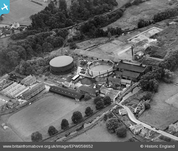
EPW058652 ENGLAND (1938). Gas Works adjacent to the Stroudwater Canal, Stroud, 1938
© Copyright OpenStreetMap contributors and licensed by the OpenStreetMap Foundation. 2026. Cartography is licensed as CC BY-SA.
Nearby Images (9)
EPW058652

EPW058651

EPW058650

EPW058649

EPW059688

EPW059689

EPW059693

EPW059696

EPW059695

Details
| Title | [EPW058652] Gas Works adjacent to the Stroudwater Canal, Stroud, 1938 |
| Reference | EPW058652 |
| Date | 18-August-1938 |
| Link | |
| Place name | STROUD |
| Parish | STROUD |
| District | |
| Country | ENGLAND |
| Easting / Northing | 384011, 204919 |
| Longitude / Latitude | -2.2315991583169, 51.742290108629 |
| National Grid Reference | SO840049 |
Pins
Be the first to add a comment to this image!
User Comment Contributions

Shows the narrow gauge rail siding coming down the hill from the Midland branch line |

cookie |
Wednesday 12th of February 2014 01:54:46 PM |