
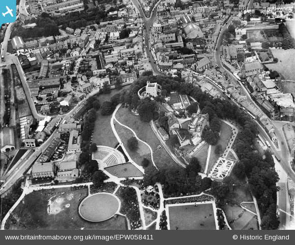
EPW058411 ENGLAND (1938). Clitheroe Castle, Clitheroe, 1938
© Copyright OpenStreetMap contributors and licensed by the OpenStreetMap Foundation. 2026. Cartography is licensed as CC BY-SA.
Nearby Images (14)
EPW058411

EAW005637

EAW005638

EPW013100

EAW005636

EAW005634

EAW005635

EPW013103

EPW013101

EPW058410

EPW038845

EPW013104

EPW058412

EPW058408

Details
| Title | [EPW058411] Clitheroe Castle, Clitheroe, 1938 |
| Reference | EPW058411 |
| Date | 28-July-1938 |
| Link | |
| Place name | CLITHEROE |
| Parish | CLITHEROE |
| District | |
| Country | ENGLAND |
| Easting / Northing | 374227, 441683 |
| Longitude / Latitude | -2.3920068105233, 53.870508050924 |
| National Grid Reference | SD742417 |
Pins
Be the first to add a comment to this image!
User Comment Contributions
Clitheroe Castle has a Wikipedia entry: en.wikipedia.org/wiki/Clitheroe_Castle |

MB |
Monday 4th of November 2013 11:31:24 PM |