
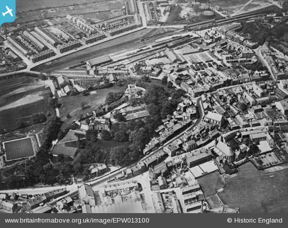
EPW013100 ENGLAND (1925). The castle, Clitheroe, 1925. This image has been produced from a copy-negative.
© Copyright OpenStreetMap contributors and licensed by the OpenStreetMap Foundation. 2026. Cartography is licensed as CC BY-SA.
Nearby Images (13)
EPW013100

EAW005635

EPW058411

EAW005634

EAW005638

EAW005637

EPW013103

EAW005636

EPW013101

EPW038845

EPW058412

EPW058410

EPW013104

Details
| Title | [EPW013100] The castle, Clitheroe, 1925. This image has been produced from a copy-negative. |
| Reference | EPW013100 |
| Date | June-1925 |
| Link | |
| Place name | CLITHEROE |
| Parish | CLITHEROE |
| District | |
| Country | ENGLAND |
| Easting / Northing | 374270, 441680 |
| Longitude / Latitude | -2.3913525464892, 53.870483218983 |
| National Grid Reference | SD743417 |
Pins
Be the first to add a comment to this image!