
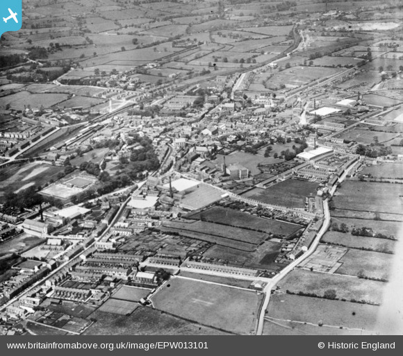
EPW013101 ENGLAND (1925). The town, Clitheroe, 1925. This image has been produced from a copy-negative.
© Copyright OpenStreetMap contributors and licensed by the OpenStreetMap Foundation. 2026. Cartography is licensed as CC BY-SA.
Nearby Images (11)
EPW013101

EAW005635

EPW038845

EAW005634

EPW013100

EPW013103

EPW058411

EAW005638

EAW005637

EAW005636

EPW058412

Details
| Title | [EPW013101] The town, Clitheroe, 1925. This image has been produced from a copy-negative. |
| Reference | EPW013101 |
| Date | June-1925 |
| Link | |
| Place name | CLITHEROE |
| Parish | CLITHEROE |
| District | |
| Country | ENGLAND |
| Easting / Northing | 374393, 441607 |
| Longitude / Latitude | -2.3894756718359, 53.869833129074 |
| National Grid Reference | SD744416 |
Pins

Ralph Pomeroy |
Monday 30th of April 2018 12:46:42 PM | |
|
Ralph Pomeroy |
Monday 30th of April 2018 12:46:08 PM | |
|
Ralph Pomeroy |
Monday 30th of April 2018 12:44:33 PM | |
|
Ralph Pomeroy |
Monday 30th of April 2018 12:43:15 PM | |
|
wadey |
Friday 9th of January 2015 02:16:07 PM |