
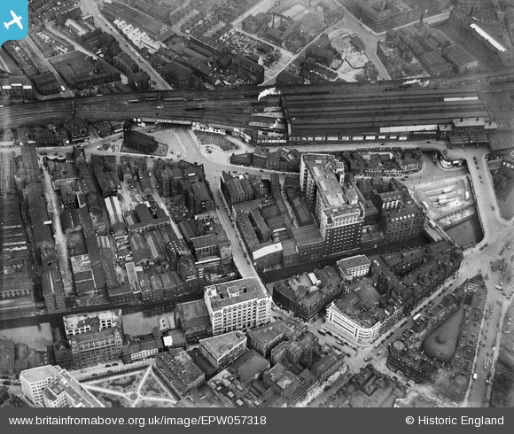
EPW057318 ENGLAND (1938). Blackfriars Street, the Telephone Exchange (Dial House), Exchange Station and environs, Salford, 1938
© Copyright OpenStreetMap contributors and licensed by the OpenStreetMap Foundation. 2026. Cartography is licensed as CC BY-SA.
Nearby Images (14)
EPW057318
, Exchange Station and environs, Salford, 1938")
EPW057317
, Exchange Station and environs, Salford, 1938")
EPW057315

EPW057694
 and environs, Salford, 1938")
EPW057695

EPW057314
 and environs, Salford, 1938")
EPW057692
 and environs, Salford, 1938")
EPW057693

EPW057316
 and environs, Manchester, 1938")
EPW019091

EAW030343

EAW030345

EAW030341

EAW016004

Details
| Title | [EPW057318] Blackfriars Street, the Telephone Exchange (Dial House), Exchange Station and environs, Salford, 1938 |
| Reference | EPW057318 |
| Date | 3-June-1938 |
| Link | |
| Place name | SALFORD |
| Parish | |
| District | |
| Country | ENGLAND |
| Easting / Northing | 383616, 398663 |
| Longitude / Latitude | -2.2469301505591, 53.484177969484 |
| National Grid Reference | SJ836987 |
Pins

chrabb |
Thursday 19th of December 2024 04:54:28 PM | |
|
chrabb |
Thursday 19th of December 2024 04:53:44 PM | |
|
chrabb |
Thursday 19th of December 2024 04:52:05 PM | |
|
Industrygeek |
Monday 18th of April 2016 10:09:15 PM | |
|
Industrygeek |
Monday 18th of April 2016 10:01:34 PM | |
|
Industrygeek |
Monday 18th of April 2016 09:56:54 PM | |
|
totoro |
Wednesday 14th of August 2013 07:01:57 PM | |
|
totoro |
Wednesday 14th of August 2013 06:55:58 PM | |
|
totoro |
Wednesday 14th of August 2013 06:40:40 PM | |
|
totoro |
Wednesday 14th of August 2013 06:35:57 PM | |
 |
totoro |
Wednesday 14th of August 2013 06:27:18 PM |
|
totoro |
Wednesday 14th of August 2013 06:19:42 PM | |
|
totoro |
Wednesday 14th of August 2013 06:12:02 PM | |
|
totoro |
Wednesday 14th of August 2013 06:11:34 PM | |
|
totoro |
Wednesday 14th of August 2013 06:10:09 PM | |
|
totoro |
Wednesday 14th of August 2013 06:09:30 PM | |
|
totoro |
Wednesday 14th of August 2013 06:08:42 PM | |
|
totoro |
Wednesday 14th of August 2013 06:07:59 PM | |
|
totoro |
Wednesday 14th of August 2013 06:07:23 PM | |
|
totoro |
Wednesday 14th of August 2013 06:06:01 PM | |
|
totoro |
Wednesday 14th of August 2013 06:05:21 PM | |
|
totoro |
Wednesday 14th of August 2013 06:04:51 PM | |
|
totoro |
Wednesday 14th of August 2013 06:03:09 PM | |
|
totoro |
Wednesday 14th of August 2013 06:02:37 PM | |
|
totoro |
Wednesday 14th of August 2013 05:59:49 PM | |
|
totoro |
Wednesday 14th of August 2013 05:58:26 PM | |
|
totoro |
Wednesday 14th of August 2013 05:57:00 PM |