
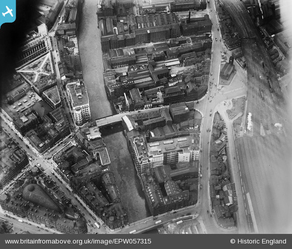
EPW057315 ENGLAND (1938). Blackfriars Street and environs, Salford, 1938. This image has been affected by flare.
© Copyright OpenStreetMap contributors and licensed by the OpenStreetMap Foundation. 2026. Cartography is licensed as CC BY-SA.
Nearby Images (12)
EPW057315

EPW057694
 and environs, Salford, 1938")
EPW057317
, Exchange Station and environs, Salford, 1938")
EPW057318
, Exchange Station and environs, Salford, 1938")
EPW057695

EPW057314
 and environs, Salford, 1938")
EPW057692
 and environs, Salford, 1938")
EPW057693

EPW057316
 and environs, Manchester, 1938")
EPW019091

EAW030345

EAW016004

Details
| Title | [EPW057315] Blackfriars Street and environs, Salford, 1938. This image has been affected by flare. |
| Reference | EPW057315 |
| Date | 3-June-1938 |
| Link | |
| Place name | SALFORD |
| Parish | |
| District | |
| Country | ENGLAND |
| Easting / Northing | 383624, 398647 |
| Longitude / Latitude | -2.2468087455913, 53.484034388084 |
| National Grid Reference | SJ836986 |
Pins

RT |
Sunday 24th of April 2022 08:51:39 PM | |
|
RT |
Sunday 24th of April 2022 08:50:47 PM | |
|
RT |
Sunday 24th of April 2022 08:50:15 PM | |
|
RT |
Sunday 24th of April 2022 08:48:53 PM | |
|
boltie |
Thursday 6th of October 2016 01:23:52 AM |