
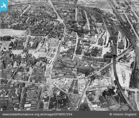
EPW057294 ENGLAND (1938). The town centre, Barnsley, 1938
© Copyright OpenStreetMap contributors and licensed by the OpenStreetMap Foundation. 2026. Cartography is licensed as CC BY-SA.
Nearby Images (15)
EPW057294

EPW061490

EPW021097

EPW055898

EAW024172

EPW061491

EAW024171

EPW055899

EPW057291

EPW057290

EPW021098

EPW021095A

EPW057292

EPW055897

EPW021099

Details
| Title | [EPW057294] The town centre, Barnsley, 1938 |
| Reference | EPW057294 |
| Date | 25-May-1938 |
| Link | |
| Place name | BARNSLEY |
| Parish | |
| District | |
| Country | ENGLAND |
| Easting / Northing | 434476, 406517 |
| Longitude / Latitude | -1.4795422713033, 53.553903732275 |
| National Grid Reference | SE345065 |
Pins

ncbnik |
Sunday 8th of January 2023 08:05:48 PM | |
|
ncbnik |
Sunday 8th of January 2023 08:04:56 PM | |
|
ncbnik |
Sunday 8th of January 2023 08:02:32 PM | |
|
ncbnik |
Sunday 8th of January 2023 08:01:24 PM | |
|
ncbnik |
Sunday 8th of January 2023 07:58:37 PM | |
|
ncbnik |
Sunday 8th of January 2023 07:57:02 PM | |
|
ncbnik |
Sunday 8th of January 2023 07:54:32 PM | |
|
John Wass |
Friday 26th of June 2020 02:29:29 PM | |
|
John Wass |
Friday 26th of June 2020 02:28:47 PM | |
|
John Wass |
Friday 26th of June 2020 02:27:23 PM |