
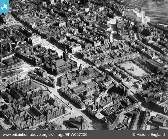
EPW057200 ENGLAND (1938). The city centre, Leeds, 1938. This image has been produced from a copy-negative.
© Copyright OpenStreetMap contributors and licensed by the OpenStreetMap Foundation. 2026. Cartography is licensed as CC BY-SA.
Nearby Images (18)
EPW057200

EAW015997

EAW014659

EPW015896

EAW015998

EAW014660

EPW043168

EAW015993

EAW015994

EPW015898

EPW057196

EAW014661

EPW052014

EPW052015

EPW052018

EPW052016

EPW052017

EAW014658

Details
| Title | [EPW057200] The city centre, Leeds, 1938. This image has been produced from a copy-negative. |
| Reference | EPW057200 |
| Date | 24-May-1938 |
| Link | |
| Place name | LEEDS |
| Parish | |
| District | |
| Country | ENGLAND |
| Easting / Northing | 429708, 433809 |
| Longitude / Latitude | -1.548905049295, 53.799520815749 |
| National Grid Reference | SE297338 |
Pins

DeeJay |
Wednesday 29th of June 2022 01:55:58 PM |