
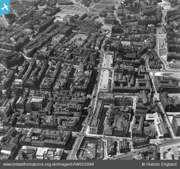
EAW015998 ENGLAND (1948). The Headrow and environs, Leeds, 1948. This image has been produced from a print.
© Copyright OpenStreetMap contributors and licensed by the OpenStreetMap Foundation. 2026. Cartography is licensed as CC BY-SA.
Nearby Images (12)
EAW015998

EAW014659

EAW015997

EPW015896

EPW015898

EPW057199

EPW057200

EAW015738

EAW014660

EPW043168

EAW015994

EAW015993

Details
| Title | [EAW015998] The Headrow and environs, Leeds, 1948. This image has been produced from a print. |
| Reference | EAW015998 |
| Date | 19-May-1948 |
| Link | |
| Place name | LEEDS |
| Parish | |
| District | |
| Country | ENGLAND |
| Easting / Northing | 429870, 433779 |
| Longitude / Latitude | -1.5464481884178, 53.799241877044 |
| National Grid Reference | SE299338 |
Pins
Be the first to add a comment to this image!