
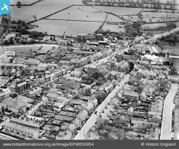
EPW056954 ENGLAND (1938). Church Street and the High Street, Fenny Stratford, 1938
© Copyright OpenStreetMap contributors and licensed by the OpenStreetMap Foundation. 2026. Cartography is licensed as CC BY-SA.
Nearby Images (5)
EPW056954

EPW056955

EPW056952

EPW056951

EPW022466

Details
| Title | [EPW056954] Church Street and the High Street, Fenny Stratford, 1938 |
| Reference | EPW056954 |
| Date | 26-April-1938 |
| Link | |
| Place name | FENNY STRATFORD |
| Parish | BLETCHLEY AND FENNY STRATFORD |
| District | |
| Country | ENGLAND |
| Easting / Northing | 488225, 234110 |
| Longitude / Latitude | -0.71477625242571, 51.997990274934 |
| National Grid Reference | SP882341 |
