
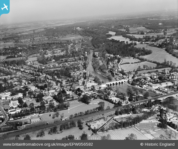
EPW056582 ENGLAND (1938). Maidenhead Bridge and the town, Maidenhead, from the south, 1938
© Copyright OpenStreetMap contributors and licensed by the OpenStreetMap Foundation. 2026. Cartography is licensed as CC BY-SA.
Nearby Images (11)
EPW056582

EAW021598

EPW022619

EPW056581

EPW005695

EPW022710

EAW026482

EAW003814

EAW013948

EPW022721

EAW003666

Details
| Title | [EPW056582] Maidenhead Bridge and the town, Maidenhead, from the south, 1938 |
| Reference | EPW056582 |
| Date | March-1938 |
| Link | |
| Place name | MAIDENHEAD |
| Parish | |
| District | |
| Country | ENGLAND |
| Easting / Northing | 489972, 181103 |
| Longitude / Latitude | -0.70306063193096, 51.521188689858 |
| National Grid Reference | SU900811 |
Pins

misterjohn |
Monday 2nd of January 2023 01:44:46 PM | |
|
designking |
Saturday 15th of October 2022 09:32:39 PM | |
|
Emily Cole |
Wednesday 28th of March 2018 12:11:39 PM |