
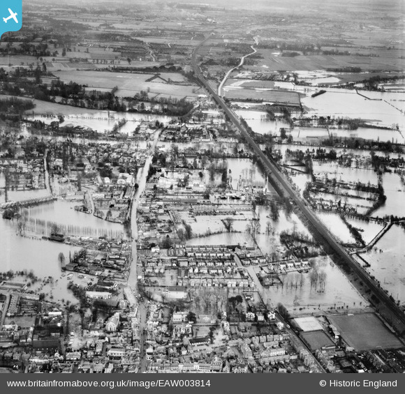
EAW003814 ENGLAND (1947). Flooding around the Great Western Railway Line and Bridge Road, Maidenhead, 1947
© Copyright OpenStreetMap contributors and licensed by the OpenStreetMap Foundation. 2026. Cartography is licensed as CC BY-SA.
Nearby Images (5)
EAW003814

EPW000901

EAW003813

EAW003815

EPW056582

Details
| Title | [EAW003814] Flooding around the Great Western Railway Line and Bridge Road, Maidenhead, 1947 |
| Reference | EAW003814 |
| Date | 19-March-1947 |
| Link | |
| Place name | MAIDENHEAD |
| Parish | |
| District | |
| Country | ENGLAND |
| Easting / Northing | 489733, 181205 |
| Longitude / Latitude | -0.70647886924447, 51.522143718744 |
| National Grid Reference | SU897812 |
Pins

spikey1810 |
Friday 11th of October 2024 02:47:44 PM | |
|
robinb |
Wednesday 24th of December 2014 12:58:11 PM |