
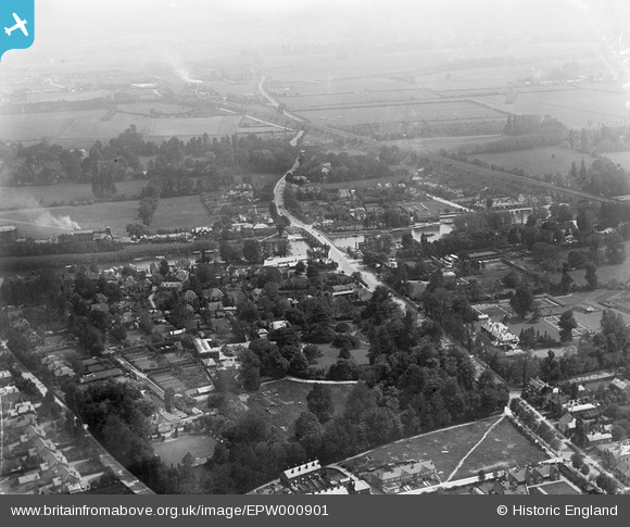
EPW000901 ENGLAND (1920). View of Maidenhead and Maidenhead Bridge, Maidenhead, from the north-west, 1920
© Copyright OpenStreetMap contributors and licensed by the OpenStreetMap Foundation. 2026. Cartography is licensed as CC BY-SA.
Nearby Images (4)
EPW000901

EAW003814

EAW003815

EAW003816

Details
| Title | [EPW000901] View of Maidenhead and Maidenhead Bridge, Maidenhead, from the north-west, 1920 |
| Reference | EPW000901 |
| Date | May-1920 |
| Link | |
| Place name | MAIDENHEAD |
| Parish | |
| District | |
| Country | ENGLAND |
| Easting / Northing | 489743, 181403 |
| Longitude / Latitude | -0.7062843089162, 51.523922184569 |
| National Grid Reference | SU897814 |
Pins

David960 |
Saturday 31st of January 2015 04:37:32 PM | |
|
David960 |
Saturday 31st of January 2015 04:36:02 PM | |
|
David960 |
Saturday 31st of January 2015 02:13:35 PM | |
|
David960 |
Saturday 31st of January 2015 02:12:29 PM | |
|
David960 |
Saturday 31st of January 2015 02:12:07 PM | |
|
David960 |
Saturday 31st of January 2015 02:11:08 PM | |
|
David960 |
Saturday 31st of January 2015 02:09:46 PM | |
|
David960 |
Saturday 31st of January 2015 02:09:27 PM | |
|
David960 |
Saturday 31st of January 2015 02:07:39 PM | |
|
David960 |
Saturday 31st of January 2015 02:07:10 PM | |
|
David960 |
Saturday 31st of January 2015 02:06:51 PM | |
|
32110 |
Friday 14th of June 2013 05:40:06 PM |