
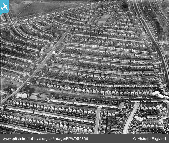
EPW056369 ENGLAND (1938). Housing between Clifford Gardens and Chelmsford Square, Kensal Rise, 1938
© Copyright OpenStreetMap contributors and licensed by the OpenStreetMap Foundation. 2026. Cartography is licensed as CC BY-SA.
Nearby Images (5)
EPW056369

EPW005600

EPW005601

EPW056370

EPW000292

Details
| Title | [EPW056369] Housing between Clifford Gardens and Chelmsford Square, Kensal Rise, 1938 |
| Reference | EPW056369 |
| Date | 9-February-1938 |
| Link | |
| Place name | KENSAL RISE |
| Parish | |
| District | |
| Country | ENGLAND |
| Easting / Northing | 523274, 183275 |
| Longitude / Latitude | -0.22246949611671, 51.534423631171 |
| National Grid Reference | TQ233833 |
Pins

Leslie B |
Friday 24th of November 2017 05:12:18 PM |