
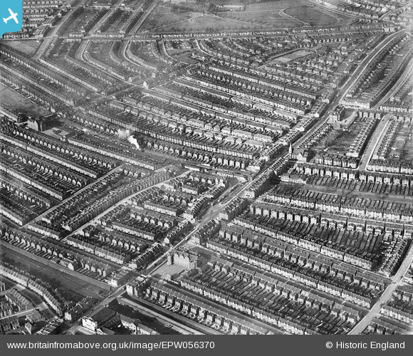
EPW056370 ENGLAND (1938). Housing around Kensal Rise Station and Chamberlayne Road, Kensal Rise, 1938
© Copyright OpenStreetMap contributors and licensed by the OpenStreetMap Foundation. 2026. Cartography is licensed as CC BY-SA.
Nearby Images (5)
EPW056370

EPW005600

EPW000292

EPW005601

EPW056369

Details
| Title | [EPW056370] Housing around Kensal Rise Station and Chamberlayne Road, Kensal Rise, 1938 |
| Reference | EPW056370 |
| Date | 9-February-1938 |
| Link | |
| Place name | KENSAL RISE |
| Parish | |
| District | |
| Country | ENGLAND |
| Easting / Northing | 523499, 183211 |
| Longitude / Latitude | -0.21924928048204, 51.533799207236 |
| National Grid Reference | TQ235832 |
Pins

Saul Marks |
Tuesday 26th of May 2026 01:47:51 AM | |
|
Leslie B |
Sunday 6th of August 2017 01:14:58 PM | |
|
Ziggy |
Friday 24th of April 2015 04:22:59 PM | |
|
Ziggy |
Friday 24th of April 2015 04:21:21 PM | |
|
Ziggy |
Friday 24th of April 2015 04:19:57 PM | |
|
Ziggy |
Friday 24th of April 2015 04:18:57 PM | |
|
Ex Kensal Riser |
Thursday 3rd of October 2013 07:05:02 AM | |
|
Ex Kensal Riser |
Thursday 3rd of October 2013 07:04:58 AM | |
|
gcook |
Monday 30th of September 2013 03:53:19 PM | |
|
gcook |
Wednesday 25th of September 2013 01:46:58 PM | |

greenchief |
Wednesday 25th of September 2013 12:32:44 PM | |
|
greenchief |
Wednesday 25th of September 2013 12:22:52 PM | |
|
greenchief |
Wednesday 25th of September 2013 12:21:25 PM | |
|
greenchief |
Wednesday 25th of September 2013 12:15:13 PM | |
|
greenchief |
Wednesday 25th of September 2013 12:13:19 PM |