
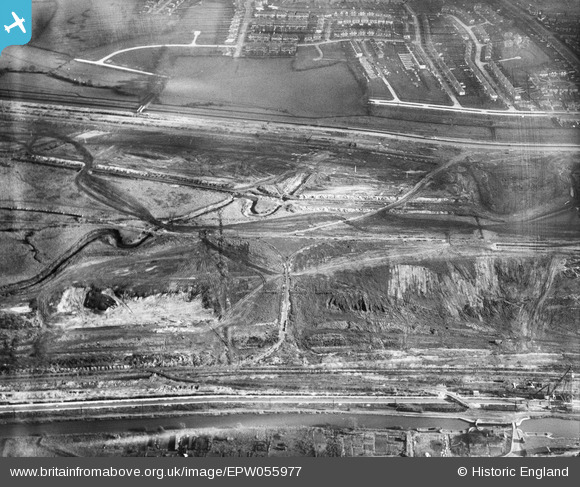
EPW055977 ENGLAND (1937). The northern section of the William Girling Reservoir under construction, Enfield, 1937
© Copyright OpenStreetMap contributors and licensed by the OpenStreetMap Foundation. 2026. Cartography is licensed as CC BY-SA.
Nearby Images (31)
EPW055977

EPW053848
 Reservoir under construction, Edmonton, 1937")
EPW055985

EPW055984

EPW056828

EPW058459
 Reservoir under construction, Edmonton, 1938")
EPW053852
 Reservoir under construction, Edmonton, 1937")
EPW060633

EPW060641

EPW060640

EPW056810

EPW060642

EPW052264

EPW056333

EPW050868

EPW053844
 Reservoir under construction, Edmonton, 1937")
EPW050864

EPW060628

EPW056812

EAW044489

EPW058472
 Reservoir under construction, Edmonton, 1938")
EAW044486

EPW055974

EPW060643

EPW056829

EPW053851
 Reservoir under construction, Edmonton, 1937")
EAW040924

EPW055969

EPW050857

EPW056318

EPW056322

Details
| Title | [EPW055977] The northern section of the William Girling Reservoir under construction, Enfield, 1937 |
| Reference | EPW055977 |
| Date | 9-November-1937 |
| Link | |
| Place name | ENFIELD |
| Parish | |
| District | |
| Country | ENGLAND |
| Easting / Northing | 536668, 193874 |
| Longitude / Latitude | -0.025328196774485, 51.626593419598 |
| National Grid Reference | TQ367939 |
Pins
Be the first to add a comment to this image!