
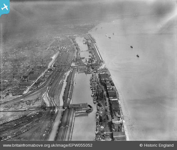
EPW055052 ENGLAND (1937). St Andrew's Dock, William Wright Dock and Albert Dock, Kingston upon Hull, from the south-west, 1937
© Copyright OpenStreetMap contributors and licensed by the OpenStreetMap Foundation. 2026. Cartography is licensed as CC BY-SA.
Nearby Images (4)
EPW055052

EPW036419

EPW036417

EAW046149

Details
| Title | [EPW055052] St Andrew's Dock, William Wright Dock and Albert Dock, Kingston upon Hull, from the south-west, 1937 |
| Reference | EPW055052 |
| Date | August-1937 |
| Link | |
| Place name | KINGSTON UPON HULL |
| Parish | |
| District | |
| Country | ENGLAND |
| Easting / Northing | 507433, 426929 |
| Longitude / Latitude | -0.37143604134769, 53.727458036163 |
| National Grid Reference | TA074269 |
Pins

GT |
Friday 22nd of November 2013 05:58:23 PM |