
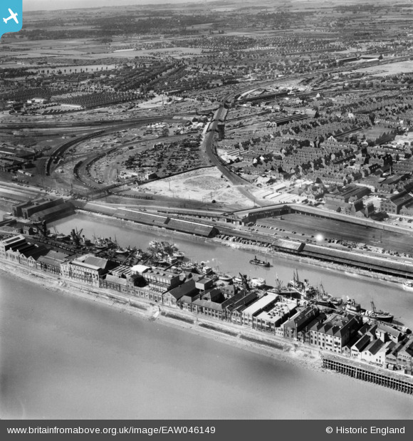
EAW046149 ENGLAND (1952). St Andrew's Dock and environs, Kingston upon Hull, from the south-east, 1952
© Copyright OpenStreetMap contributors and licensed by the OpenStreetMap Foundation. 2026. Cartography is licensed as CC BY-SA.
Nearby Images (4)
EAW046149

EPW055052

EPW036419

EPW036417

Details
| Title | [EAW046149] St Andrew's Dock and environs, Kingston upon Hull, from the south-east, 1952 |
| Reference | EAW046149 |
| Date | 22-August-1952 |
| Link | |
| Place name | KINGSTON UPON HULL |
| Parish | |
| District | |
| Country | ENGLAND |
| Easting / Northing | 507613, 426943 |
| Longitude / Latitude | -0.36870378841022, 53.727546728333 |
| National Grid Reference | TA076269 |
Pins

Mark P |
Friday 18th of November 2022 10:50:49 PM | |
|
Mark P |
Friday 18th of November 2022 10:49:55 PM | |
|
John Wass |
Tuesday 2nd of September 2014 03:47:09 PM | |
|
John Wass |
Tuesday 19th of August 2014 09:01:19 PM |