
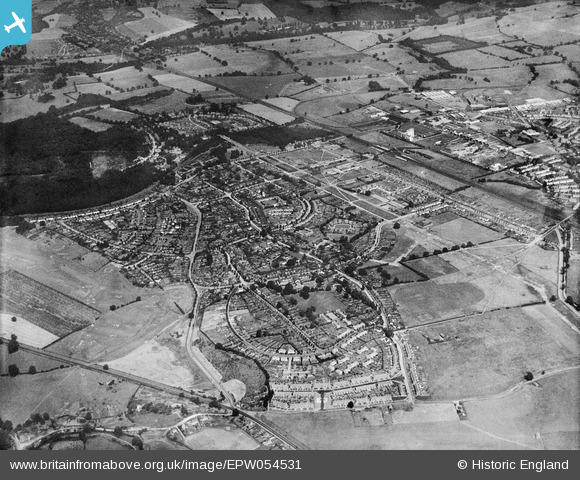
EPW054531 ENGLAND (1937). The residential area at Handside, Welwyn Garden City, 1937
© Copyright OpenStreetMap contributors and licensed by the OpenStreetMap Foundation. 2026. Cartography is licensed as CC BY-SA.
Nearby Images (16)
EPW054531

EPW047376

EPW054532

EPW047377

EPW054523

EPW054524

EPW054540A

EPW054542

EPW022019

EPW009815

EPW013426

EPW054540

EPW047379

EAW020865

EAW013998

EPW025529

Details
| Title | [EPW054531] The residential area at Handside, Welwyn Garden City, 1937 |
| Reference | EPW054531 |
| Date | 30-July-1937 |
| Link | |
| Place name | WELWYN GARDEN CITY |
| Parish | |
| District | |
| Country | ENGLAND |
| Easting / Northing | 523252, 212742 |
| Longitude / Latitude | -0.21238992372374, 51.799274761056 |
| National Grid Reference | TL233127 |
Pins
Be the first to add a comment to this image!