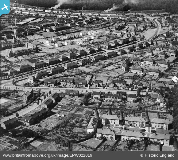
EPW022019 ENGLAND (1928). Youngs Rise and Valley Road, Welwyn Garden City, 1928
    © Copyright OpenStreetMap contributors and licensed by the OpenStreetMap Foundation. 2025. Cartography is licensed as CC BY-SA.
  
Nearby Images (12)
Details
| Title | [EPW022019] Youngs Rise and Valley Road, Welwyn Garden City, 1928 | 
| Reference | EPW022019 | 
| Date | July-1928 | 
| Link | |
| Place name | WELWYN GARDEN CITY | 
| Parish | |
| District | |
| Country | ENGLAND | 
| Easting / Northing | 523050, 212850 | 
| Longitude / Latitude | -0.21527980049029, 51.80028992171 | 
| National Grid Reference | TL231129 | 
Pins
|  Little Youngs |   Paul | Friday 31st of October 2014 01:10:28 AM | 
|  High Grove |   Paul | Friday 31st of October 2014 01:09:38 AM | 
|  Valley Way |   Paul | Friday 31st of October 2014 01:09:03 AM | 
|  Youngs Rise |   Paul | Friday 31st of October 2014 01:08:43 AM | 
|  Elm Gardens |   Paul | Friday 31st of October 2014 01:08:27 AM | 
|  Dellcott Family Club |   mjr | Tuesday 26th of June 2012 11:42:47 AM | 
 
             
  ![[EPW022019] Youngs Rise and Valley Road, Welwyn Garden City, 1928](http://britainfromabove.org.uk/sites/all/libraries/aerofilms-images/public/100x100/EPW/022/EPW022019.jpg) 
  
                                          ![[EAW020863] Smoke rising from a distant chimney beyond the town, Welwyn Garden City, from the south-west, 1949](http://britainfromabove.org.uk/sites/all/libraries/aerofilms-images/public/100x100/EAW/020/EAW020863.jpg) 
 ![[EPW009816] Valley Road and surroundings, Welwyn Garden City, 1924](http://britainfromabove.org.uk/sites/all/libraries/aerofilms-images/public/100x100/EPW/009/EPW009816.jpg) 
 ![[EPW054523] The residential area at Handside and Sherrardspark Wood, Welwyn Garden City, 1937](http://britainfromabove.org.uk/sites/all/libraries/aerofilms-images/public/100x100/EPW/054/EPW054523.jpg) 
 ![[EPW022029] The Town Centre, Welwyn Garden City, from the west, 1928](http://britainfromabove.org.uk/sites/all/libraries/aerofilms-images/public/100x100/EPW/022/EPW022029.jpg) 
 ![[EPW054532] The residential area at Handside, Welwyn Garden City, 1937](http://britainfromabove.org.uk/sites/all/libraries/aerofilms-images/public/100x100/EPW/054/EPW054532.jpg) 
 ![[EPW054524] The residential area at Handside and Sherrardspark Wood, Welwyn Garden City, 1937](http://britainfromabove.org.uk/sites/all/libraries/aerofilms-images/public/100x100/EPW/054/EPW054524.jpg) 
 ![[EPW009815] Handside Lane and surroundings, Welwyn Garden City, 1924](http://britainfromabove.org.uk/sites/all/libraries/aerofilms-images/public/100x100/EPW/009/EPW009815.jpg) 
 ![[EPW054531] The residential area at Handside, Welwyn Garden City, 1937](http://britainfromabove.org.uk/sites/all/libraries/aerofilms-images/public/100x100/EPW/054/EPW054531.jpg) 
 ![[EPW054543] The residential area surrounding Brockett Close, Dognell Green and Dellcott Close, Handside, 1937](http://britainfromabove.org.uk/sites/all/libraries/aerofilms-images/public/100x100/EPW/054/EPW054543.jpg) 
 ![[EPW047368] Handside Lane and environs, Welwyn Garden City, 1935](http://britainfromabove.org.uk/sites/all/libraries/aerofilms-images/public/100x100/EPW/047/EPW047368.jpg) 
 ![[EPW047369] Handside Lane and environs, Welwyn Garden City, 1935](http://britainfromabove.org.uk/sites/all/libraries/aerofilms-images/public/100x100/EPW/047/EPW047369.jpg)