
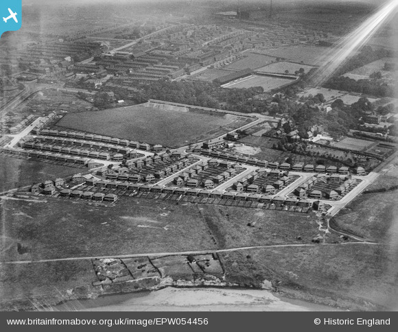
EPW054456 ENGLAND (1937). The residential area surrounding Windermere Drive and Coniston Drive and Bury Football Ground, Redvales, 1937. This image has been affected by flare.
© Copyright OpenStreetMap contributors and licensed by the OpenStreetMap Foundation. 2026. Cartography is licensed as CC BY-SA.
Nearby Images (5)
EPW054456

EPW054454

EPW054453

EPW054455

EPW054457

Details
| Title | [EPW054456] The residential area surrounding Windermere Drive and Coniston Drive and Bury Football Ground, Redvales, 1937. This image has been affected by flare. |
| Reference | EPW054456 |
| Date | 30-July-1937 |
| Link | |
| Place name | REDVALES |
| Parish | |
| District | |
| Country | ENGLAND |
| Easting / Northing | 380237, 409174 |
| Longitude / Latitude | -2.2985195304157, 53.578548363516 |
| National Grid Reference | SD802092 |
Pins
Be the first to add a comment to this image!