
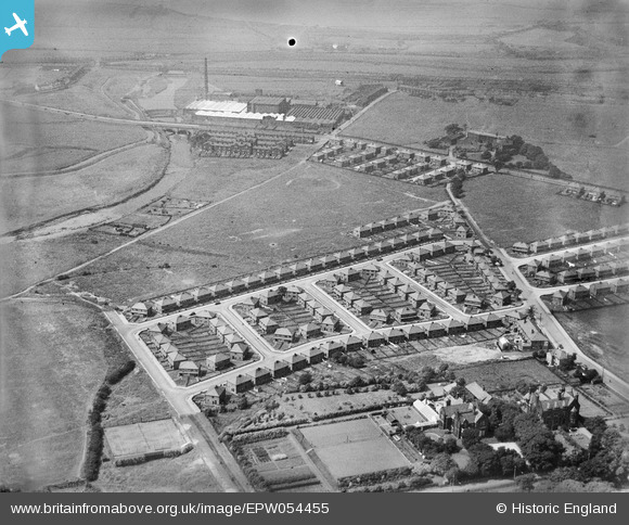
EPW054455 ENGLAND (1937). The residential area surrounding Windermere Drive and Coniston Drive and the Warth Cotton Weaving Mills, Redvales, 1937. This image has been produced from a damaged negative.
© Copyright OpenStreetMap contributors and licensed by the OpenStreetMap Foundation. 2026. Cartography is licensed as CC BY-SA.
Nearby Images (5)
EPW054455

EPW054454

EPW054456

EPW054453

EPW054457

Details
| Title | [EPW054455] The residential area surrounding Windermere Drive and Coniston Drive and the Warth Cotton Weaving Mills, Redvales, 1937. This image has been produced from a damaged negative. |
| Reference | EPW054455 |
| Date | 30-July-1937 |
| Link | |
| Place name | REDVALES |
| Parish | |
| District | |
| Country | ENGLAND |
| Easting / Northing | 380098, 409086 |
| Longitude / Latitude | -2.3006134778579, 53.577752055202 |
| National Grid Reference | SD801091 |
