
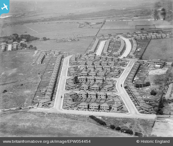
EPW054454 ENGLAND (1937). The residential area surrounding Windermere Drive and Coniston Drive, Redvales 1937
© Copyright OpenStreetMap contributors and licensed by the OpenStreetMap Foundation. 2026. Cartography is licensed as CC BY-SA.
Nearby Images (5)
EPW054454

EPW054456

EPW054455

EPW054453

EPW054457

Details
| Title | [EPW054454] The residential area surrounding Windermere Drive and Coniston Drive, Redvales 1937 |
| Reference | EPW054454 |
| Date | 30-July-1937 |
| Link | |
| Place name | REDVALES |
| Parish | |
| District | |
| Country | ENGLAND |
| Easting / Northing | 380171, 409131 |
| Longitude / Latitude | -2.2995137114147, 53.578159335516 |
| National Grid Reference | SD802091 |
Pins
Be the first to add a comment to this image!