
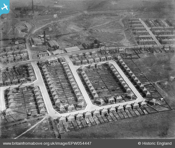
EPW054447 ENGLAND (1937). Housing surrounding Edna Road, Eva Street and Ena Crescent, Westleigh, 1937. This image has been produced from a damaged negative.
© Copyright OpenStreetMap contributors and licensed by the OpenStreetMap Foundation. 2026. Cartography is licensed as CC BY-SA.
Nearby Images (9)
EPW054447

EPW054443

EPW054440

EPW054441

EPW055094

EPW054445

EPW054446

EPW054444

EPW054442

Details
| Title | [EPW054447] Housing surrounding Edna Road, Eva Street and Ena Crescent, Westleigh, 1937. This image has been produced from a damaged negative. |
| Reference | EPW054447 |
| Date | 30-July-1937 |
| Link | |
| Place name | WESTLEIGH |
| Parish | |
| District | |
| Country | ENGLAND |
| Easting / Northing | 364458, 401176 |
| Longitude / Latitude | -2.5359430585735, 53.505822259662 |
| National Grid Reference | SD645012 |
Pins

Dave |
Thursday 29th of August 2013 12:35:50 PM |