
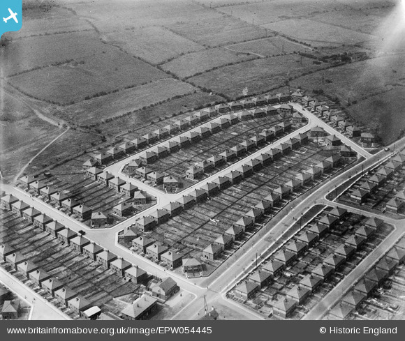
EPW054445 ENGLAND (1937). Housing surrounding Douglas Road and Laxey Crescent, Westleigh, 1937. This image has been produced from a damaged negative.
© Copyright OpenStreetMap contributors and licensed by the OpenStreetMap Foundation. 2026. Cartography is licensed as CC BY-SA.
Nearby Images (9)
EPW054445

EPW054446

EPW054442

EPW054444

EPW054441

EPW054440

EPW054443

EPW054447

EPW055094

Details
| Title | [EPW054445] Housing surrounding Douglas Road and Laxey Crescent, Westleigh, 1937. This image has been produced from a damaged negative. |
| Reference | EPW054445 |
| Date | 30-July-1937 |
| Link | |
| Place name | WESTLEIGH |
| Parish | |
| District | |
| Country | ENGLAND |
| Easting / Northing | 364304, 401348 |
| Longitude / Latitude | -2.5382847235348, 53.50735794441 |
| National Grid Reference | SD643013 |
Pins
Be the first to add a comment to this image!