
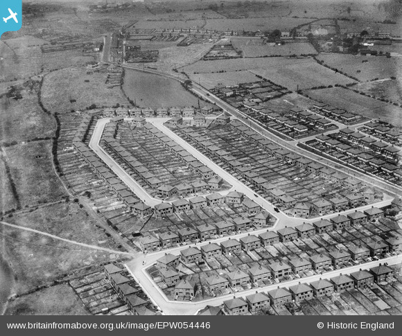
EPW054446 ENGLAND (1937). Housing surrounding Douglas Road and Laxey Crescent, Westleigh, 1937. This image has been produced from a damaged negative.
© Copyright OpenStreetMap contributors and licensed by the OpenStreetMap Foundation. 2026. Cartography is licensed as CC BY-SA.
Nearby Images (9)
EPW054446

EPW054444

EPW054445

EPW054442

EPW054441

EPW054440

EPW054447

EPW054443

EPW055094

Details
| Title | [EPW054446] Housing surrounding Douglas Road and Laxey Crescent, Westleigh, 1937. This image has been produced from a damaged negative. |
| Reference | EPW054446 |
| Date | 30-July-1937 |
| Link | |
| Place name | WESTLEIGH |
| Parish | |
| District | |
| Country | ENGLAND |
| Easting / Northing | 364323, 401365 |
| Longitude / Latitude | -2.5380001583846, 53.507512047981 |
| National Grid Reference | SD643014 |
Pins

ian |
Sunday 30th of August 2015 02:53:07 PM | |
|
ian |
Sunday 30th of August 2015 02:51:53 PM | |
|
ian |
Sunday 30th of August 2015 02:42:49 PM | |
|
ian |
Sunday 30th of August 2015 02:41:34 PM | |
|
ian |
Sunday 30th of August 2015 02:41:02 PM | |
|
ian |
Sunday 30th of August 2015 02:40:09 PM | |
|
ian |
Sunday 30th of August 2015 02:39:06 PM |