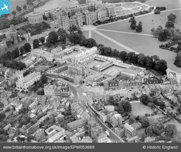
EPW053888 ENGLAND (1937). The Royal Mews and environs, Windsor, 1937
© Copyright OpenStreetMap contributors and licensed by the OpenStreetMap Foundation. 2026. Cartography is licensed as CC BY-SA.
Nearby Images (37)
EPW053888

EAW003781

EPW056590

EAW003703

EAW053001

EPW046518

EPW005692

EPW022606

EPW046522

EAW003704

EAW004844

EAW021007

EPW000036

EPW034875

EAW026475

EPR000458

EPW012468

EPW001600

EPW056591

EAW004842

EAW026474

EPR000457

EAW038574

EPW056592

EAW003705

EPW005693

EAW004841

EPW046517

EPW046520

EPW046521

EAW004840

EPW000035

EPW022598

EPW046519

EPW022597

EAW006326

EPW047391

Details
| Title | [EPW053888] The Royal Mews and environs, Windsor, 1937 |
| Reference | EPW053888 |
| Date | 25-June-1937 |
| Link | |
| Place name | WINDSOR |
| Parish | |
| District | |
| Country | ENGLAND |
| Easting / Northing | 496963, 176755 |
| Longitude / Latitude | -0.603512375154, 51.480943749174 |
| National Grid Reference | SU970768 |
Pins
Be the first to add a comment to this image!