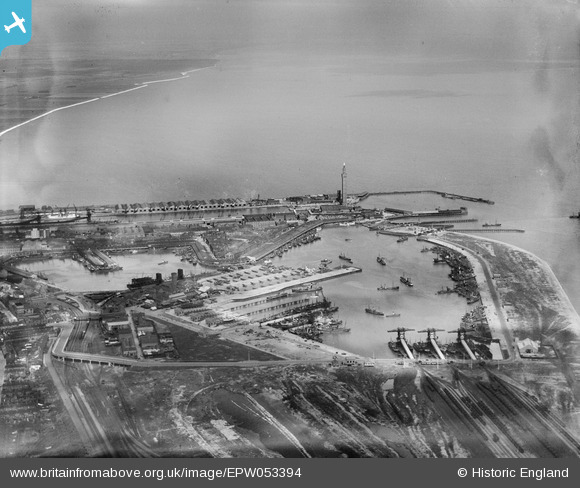
EPW053394 ENGLAND (1937). Grimsby Docks, Grimsby, from the south-east, 1937
© Copyright OpenStreetMap contributors and licensed by the OpenStreetMap Foundation. 2026. Cartography is licensed as CC BY-SA.
Nearby Images (7)
Details
| Title | [EPW053394] Grimsby Docks, Grimsby, from the south-east, 1937 |
| Reference | EPW053394 |
| Date | 31-May-1937 |
| Link | |
| Place name | GRIMSBY |
| Parish | |
| District | |
| Country | ENGLAND |
| Easting / Northing | 528338, 410769 |
| Longitude / Latitude | -0.061397633722858, 53.577551411822 |
| National Grid Reference | TA283108 |


![[EPW053394] Grimsby Docks, Grimsby, from the south-east, 1937](http://britainfromabove.org.uk/sites/all/libraries/aerofilms-images/public/100x100/EPW/053/EPW053394.jpg)
![[EAW029006] Grimsby Fish Docks, Grimsby, 1950. This image was marked by Aerofilms Ltd for photo editing.](http://britainfromabove.org.uk/sites/all/libraries/aerofilms-images/public/100x100/EAW/029/EAW029006.jpg)
![[EAW040600] The Fish Docks, Grimsby, 1951](http://britainfromabove.org.uk/sites/all/libraries/aerofilms-images/public/100x100/EAW/040/EAW040600.jpg)
![[EAW029005] Grimsby Fish Docks, Grimsby, 1950. This image was marked by Aerofilms Ltd for photo editing.](http://britainfromabove.org.uk/sites/all/libraries/aerofilms-images/public/100x100/EAW/029/EAW029005.jpg)
![[EAW029009] Grimsby Fish Docks, Grimsby, 1950. This image was marked by Aerofilms Ltd for photo editing.](http://britainfromabove.org.uk/sites/all/libraries/aerofilms-images/public/100x100/EAW/029/EAW029009.jpg)
![[EAW029010] Grimsby Fish Docks, Grimsby, 1950. This image was marked by Aerofilms Ltd for photo editing.](http://britainfromabove.org.uk/sites/all/libraries/aerofilms-images/public/100x100/EAW/029/EAW029010.jpg)
![[EPW053384] Grimsby Docks, Grimsby, 1937](http://britainfromabove.org.uk/sites/all/libraries/aerofilms-images/public/100x100/EPW/053/EPW053384.jpg)
