
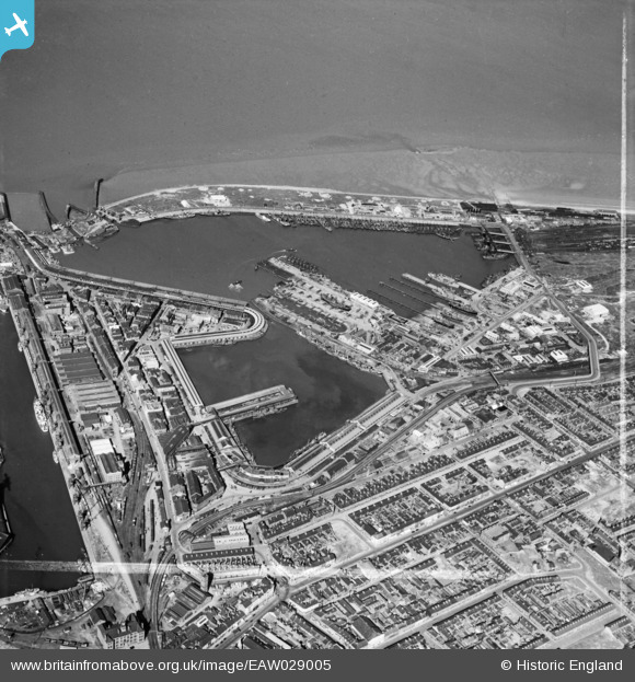
EAW029005 ENGLAND (1950). Grimsby Fish Docks, Grimsby, 1950. This image was marked by Aerofilms Ltd for photo editing.
© Copyright OpenStreetMap contributors and licensed by the OpenStreetMap Foundation. 2026. Cartography is licensed as CC BY-SA.
Nearby Images (6)
EAW029005

EAW029009

EPW053394

EAW040600

EAW029006

EPW053384

Details
| Title | [EAW029005] Grimsby Fish Docks, Grimsby, 1950. This image was marked by Aerofilms Ltd for photo editing. |
| Reference | EAW029005 |
| Date | 10-May-1950 |
| Link | |
| Place name | GRIMSBY |
| Parish | |
| District | |
| Country | ENGLAND |
| Easting / Northing | 528170, 410808 |
| Longitude / Latitude | -0.063917740948058, 53.577942877794 |
| National Grid Reference | TA282108 |
Pins

redmist |
Wednesday 31st of October 2018 01:27:15 PM | |

Class31 |
Tuesday 24th of May 2016 10:17:00 PM | |
|
Class31 |
Monday 3rd of March 2014 07:51:43 PM | |
|
Class31 |
Monday 3rd of March 2014 07:32:15 PM | |
|
Class31 |
Monday 3rd of March 2014 05:59:33 PM |
