
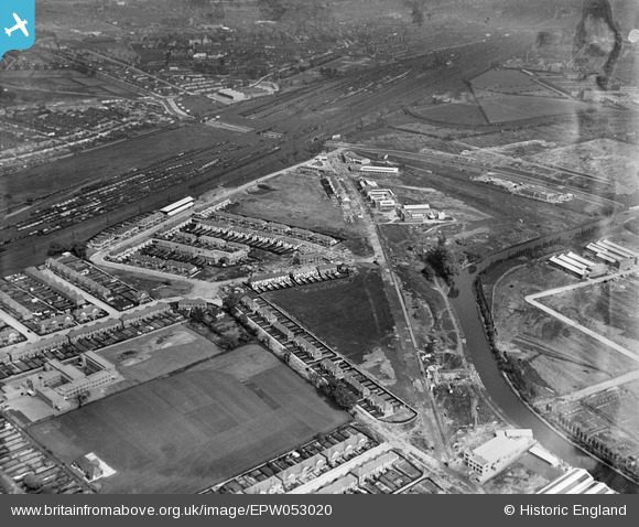
EPW053020 ENGLAND (1937). Construction of housing and industrial buildings along Beresford Avenue and environs, Alperton, 1937
© Copyright OpenStreetMap contributors and licensed by the OpenStreetMap Foundation. 2026. Cartography is licensed as CC BY-SA.
Nearby Images (36)
EPW053020

EPW051673

EPW056462

EPW056465

EPW056417
, Alperton, 1938")
EPW056414
, Alperton, 1938")
EPW051674

EPW053021

EPW056416
, Alperton, 1938")
EAW026663

EPW056463

EPW051678

EPW056420
, Alperton, 1938")
EPW056418
, Alperton, 1938. This image has been affected by flare.")
EPW056464

EPW056466

EPW056419
, Alperton, 1938")
EPW056415
, Alperton, 1938")
EAW026665

EAW026662

EPW051680

EPW056461

EPW056460

EPW051676

EPW056762

EAW026664

EAW026668

EPW053018

EAW026666

EPW056757

EAW026667

EPW051675

EPW053017

EPW052465

EPW053019

EPW053016

Details
| Title | [EPW053020] Construction of housing and industrial buildings along Beresford Avenue and environs, Alperton, 1937 |
| Reference | EPW053020 |
| Date | 17-May-1937 |
| Link | |
| Place name | ALPERTON |
| Parish | |
| District | |
| Country | ENGLAND |
| Easting / Northing | 519101, 183934 |
| Longitude / Latitude | -0.28238881858795, 51.5412429699 |
| National Grid Reference | TQ191839 |
Pins

Rudgey |
Friday 23rd of September 2016 01:40:21 PM |