
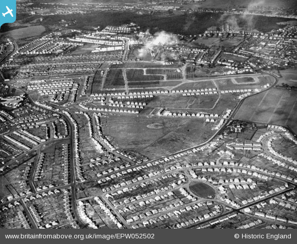
EPW052502 ENGLAND (1937). Residential development to the south of Lesnes Abbey Woods, Bexleyheath, 1937. This image has been produced from a print.
© Copyright OpenStreetMap contributors and licensed by the OpenStreetMap Foundation. 2026. Cartography is licensed as CC BY-SA.
Nearby Images (4)
EPW052502

EPW052511

EPW052513

EPW052505

Details
| Title | [EPW052502] Residential development to the south of Lesnes Abbey Woods, Bexleyheath, 1937. This image has been produced from a print. |
| Reference | EPW052502 |
| Date | 27-February-1937 |
| Link | |
| Place name | BEXLEYHEATH |
| Parish | |
| District | |
| Country | ENGLAND |
| Easting / Northing | 548775, 177052 |
| Longitude / Latitude | 0.14236001799136, 51.472357801655 |
| National Grid Reference | TQ488771 |
Pins

Jim Lawson |
Thursday 25th of September 2025 06:03:20 PM | |
|
Don65 |
Thursday 7th of May 2020 02:57:42 PM | |
|
Don65 |
Thursday 7th of May 2020 02:54:53 PM | |
|
Don65 |
Thursday 7th of May 2020 02:53:45 PM | |
|
Don65 |
Thursday 7th of May 2020 02:52:01 PM | |
|
Leachy |
Wednesday 1st of January 2020 09:55:39 PM |