
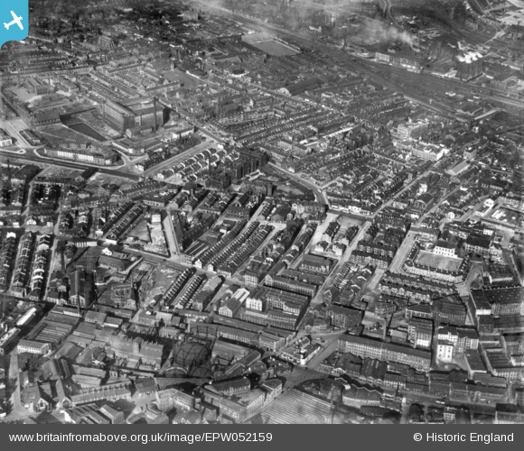
EPW052159 ENGLAND (1936). Bradford Royal Infirmary and environs, Bradford, 1936. This image has been produced from a print.
© Copyright OpenStreetMap contributors and licensed by the OpenStreetMap Foundation. 2026. Cartography is licensed as CC BY-SA.
Nearby Images (4)
EPW052159

EPW057185

EPW054320

EPW057190

Details
| Title | [EPW052159] Bradford Royal Infirmary and environs, Bradford, 1936. This image has been produced from a print. |
| Reference | EPW052159 |
| Date | October-1936 |
| Link | |
| Place name | BRADFORD |
| Parish | |
| District | |
| Country | ENGLAND |
| Easting / Northing | 415722, 433467 |
| Longitude / Latitude | -1.7612870849415, 53.797057318801 |
| National Grid Reference | SE157335 |
Pins

alpaul |
Wednesday 19th of July 2023 11:25:08 PM | |
|
alpaul |
Wednesday 19th of July 2023 11:23:14 PM | |
|
Shipley Flyer |
Sunday 18th of June 2023 09:41:04 AM |