
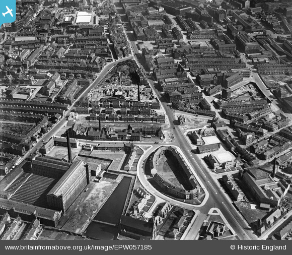
EPW057185 ENGLAND (1938). Jervaulx Crescent, the Lumb Lane Worsted Mills and the surrounding residential area, Bradford, 1938
© Copyright OpenStreetMap contributors and licensed by the OpenStreetMap Foundation. 2026. Cartography is licensed as CC BY-SA.
Nearby Images (2)
EPW057185

EPW052159

Details
| Title | [EPW057185] Jervaulx Crescent, the Lumb Lane Worsted Mills and the surrounding residential area, Bradford, 1938 |
| Reference | EPW057185 |
| Date | 24-May-1938 |
| Link | |
| Place name | BRADFORD |
| Parish | |
| District | |
| Country | ENGLAND |
| Easting / Northing | 415620, 433656 |
| Longitude / Latitude | -1.7628261883786, 53.798759300204 |
| National Grid Reference | SE156337 |
Pins
Be the first to add a comment to this image!