
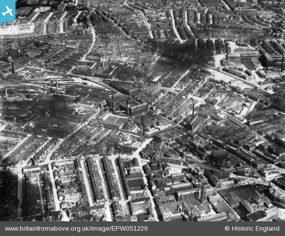
EPW051229 ENGLAND (1936). Lister Hills and environs, Bradford, 1936. This image has been produced from a print.
© Copyright OpenStreetMap contributors and licensed by the OpenStreetMap Foundation. 2026. Cartography is licensed as CC BY-SA.
Nearby Images (5)
EPW051229

EPW052160

EPW024498

EPW024500

EAW030797

Details
| Title | [EPW051229] Lister Hills and environs, Bradford, 1936. This image has been produced from a print. |
| Reference | EPW051229 |
| Date | July-1936 |
| Link | |
| Place name | BRADFORD |
| Parish | |
| District | |
| Country | ENGLAND |
| Easting / Northing | 415319, 433389 |
| Longitude / Latitude | -1.7674098054699, 53.796368204145 |
| National Grid Reference | SE153334 |
Pins

Paul McGowan |
Tuesday 9th of February 2016 12:41:55 PM | |
|
Paul McGowan |
Tuesday 9th of February 2016 12:39:35 PM |