
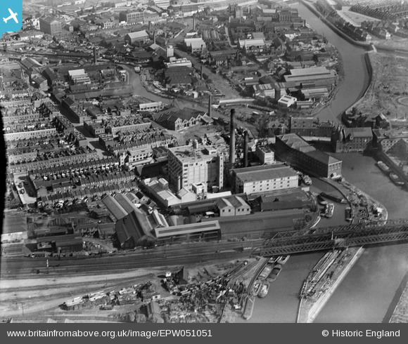
EPW051051 ENGLAND (1936). The Kemball, Bishop and Co Ltd Crown Chemical Works, Bromley, 1936
© Copyright OpenStreetMap contributors and licensed by the OpenStreetMap Foundation. 2026. Cartography is licensed as CC BY-SA.
Nearby Images (27)
EPW051051

EPW034627

EPW034625

EPW034631

EPW034629

EPW034628

EPW034633

EPW034630

EAW028116

EPW045658

EPW034634

EPW034632

EPW034626

EAW028115

EPW051050

EPW045655

EAW028117
 and the surrounding area, Bromley, 1950. This image has been produced from a damaged negative.")
EPW045657

EPW045656

EAW028114

EAW028113

EAW028112
, Bromley, 1950. This image has been produced from a damaged negative.")
EAW028111

EPW045659

EAW028110

EPW009706

EAW014565

Details
| Title | [EPW051051] The Kemball, Bishop and Co Ltd Crown Chemical Works, Bromley, 1936 |
| Reference | EPW051051 |
| Date | July-1936 |
| Link | |
| Place name | BROMLEY |
| Parish | |
| District | |
| Country | ENGLAND |
| Easting / Northing | 538204, 182686 |
| Longitude / Latitude | -0.007552334925118, 51.525672356772 |
| National Grid Reference | TQ382827 |
Pins
Be the first to add a comment to this image!