
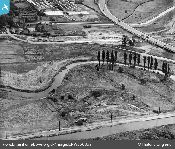
EPW050859 ENGLAND (1936). The River Lea at Lower Hall Lane, Edmonton, 1936
© Copyright OpenStreetMap contributors and licensed by the OpenStreetMap Foundation. 2026. Cartography is licensed as CC BY-SA.
Nearby Images (26)
EPW050859

EPW056320

EPW055981

EPW052271

EPW056823

EPW058467

EPW056816

EPW056321

EPW058457

EPW053836

EPW055980

EPW049703

EPW052282

EPW052287

EPW018565

EPW049696

EPW049529

EPW018567

EPW056821

EPW056818

EPW053837

EPW056319

EPW060635

EPW052274

EPW049710

EPW056815

Details
| Title | [EPW050859] The River Lea at Lower Hall Lane, Edmonton, 1936 |
| Reference | EPW050859 |
| Date | July-1936 |
| Link | |
| Place name | EDMONTON |
| Parish | |
| District | |
| Country | ENGLAND |
| Easting / Northing | 536033, 192481 |
| Longitude / Latitude | -0.035038253572138, 51.614228386661 |
| National Grid Reference | TQ360925 |
Pins
Be the first to add a comment to this image!