
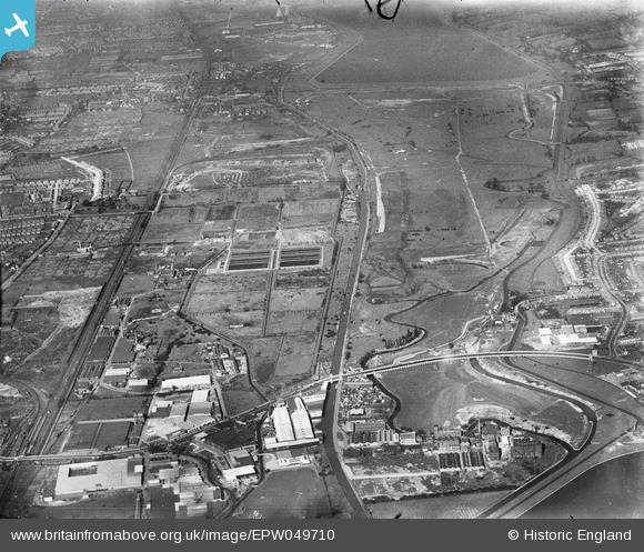
EPW049710 ENGLAND (1936). The site of the William Girling Reservoir, Edmonton, from the south-west, 1936
© Copyright OpenStreetMap contributors and licensed by the OpenStreetMap Foundation. 2026. Cartography is licensed as CC BY-SA.
Nearby Images (19)
EPW049710

EPW049711

EPW049703

EPW018565

EPW049726

EPW049723

EPW018567

EPW031949

EPW031950

EPW049529

EPW031947

EPW048909

EPW031952

EPW056321

EPW031946

EPW031948

EPW052282

EPW050859

EPW052272

Details
| Title | [EPW049710] The site of the William Girling Reservoir, Edmonton, from the south-west, 1936 |
| Reference | EPW049710 |
| Date | March-1936 |
| Link | |
| Place name | EDMONTON |
| Parish | |
| District | |
| Country | ENGLAND |
| Easting / Northing | 535788, 192327 |
| Longitude / Latitude | -0.03863465533682, 51.612903539295 |
| National Grid Reference | TQ358923 |
Pins
Be the first to add a comment to this image!