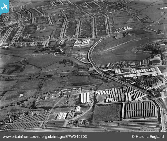
EPW049703 ENGLAND (1936). The junction of Lower Hall Lane and the North Circular Road and environs, Edmonton, 1936
    © Copyright OpenStreetMap contributors and licensed by the OpenStreetMap Foundation. 2025. Cartography is licensed as CC BY-SA.
  
Nearby Images (21)
Details
| Title | [EPW049703] The junction of Lower Hall Lane and the North Circular Road and environs, Edmonton, 1936 | 
| Reference | EPW049703 | 
| Date | March-1936 | 
| Link | |
| Place name | EDMONTON | 
| Parish | |
| District | |
| Country | ENGLAND | 
| Easting / Northing | 535925, 192337 | 
| Longitude / Latitude | -0.036653155196091, 51.612960343405 | 
| National Grid Reference | TQ359923 | 
Pins
|  Chase Lane School |   G.Martin | Monday 2nd of June 2014 08:56:18 PM | 
 
             
  ![[EPW049703] The junction of Lower Hall Lane and the North Circular Road and environs, Edmonton, 1936](http://britainfromabove.org.uk/sites/all/libraries/aerofilms-images/public/100x100/EPW/049/EPW049703.jpg) 
  
                                          ![[EPW018565] Cook's Ferry Public House and the Lea Valley Viaduct and environs, Edmonton, 1927](http://britainfromabove.org.uk/sites/all/libraries/aerofilms-images/public/100x100/EPW/018/EPW018565.jpg) 
 ![[EPW018567] Cook's Ferry Public House and the Lea Valley Viaduct and environs, Edmonton, 1927](http://britainfromabove.org.uk/sites/all/libraries/aerofilms-images/public/100x100/EPW/018/EPW018567.jpg) 
 ![[EPW049529] The Sparklet Works and other industrial buildings along the North Circular Road , Upper Edmonton, 1935](http://britainfromabove.org.uk/sites/all/libraries/aerofilms-images/public/100x100/EPW/049/EPW049529.jpg) 
 ![[EPW056321] The junction of the North Circular Road and Lower Hall Lane, Edmonton, 1938](http://britainfromabove.org.uk/sites/all/libraries/aerofilms-images/public/100x100/EPW/056/EPW056321.jpg) 
 ![[EPW052282] The junction of Lower Hall Lane and the North Circular Road, Edmonton, 1936. This image has been produced from a damaged negative.](http://britainfromabove.org.uk/sites/all/libraries/aerofilms-images/public/100x100/EPW/052/EPW052282.jpg) 
 ![[EPW049710] The site of the William Girling Reservoir, Edmonton, from the south-west, 1936](http://britainfromabove.org.uk/sites/all/libraries/aerofilms-images/public/100x100/EPW/049/EPW049710.jpg) 
 ![[EPW056823] The junction of Lower Hall Lane and the North Circular Road, Edmonton, 1938](http://britainfromabove.org.uk/sites/all/libraries/aerofilms-images/public/100x100/EPW/056/EPW056823.jpg) 
 ![[EPW056816] The junction of the North Circular Road and Lower Hall Lane, Edmonton, 1938](http://britainfromabove.org.uk/sites/all/libraries/aerofilms-images/public/100x100/EPW/056/EPW056816.jpg) 
 ![[EPW052271] The junction of Lower Hall Lane and the North Circular Road, Edmonton, 1936. This image has been produced from a damaged negative.](http://britainfromabove.org.uk/sites/all/libraries/aerofilms-images/public/100x100/EPW/052/EPW052271.jpg) 
 ![[EPW050859] The River Lea at Lower Hall Lane, Edmonton, 1936](http://britainfromabove.org.uk/sites/all/libraries/aerofilms-images/public/100x100/EPW/050/EPW050859.jpg) 
 ![[EPW053837] The North Circular Road and the River Lea, Edmonton, 1937](http://britainfromabove.org.uk/sites/all/libraries/aerofilms-images/public/100x100/EPW/053/EPW053837.jpg) 
 ![[EPW056818] The junction of Lower Hall Lane and the North Circular Road, Edmonton, 1938](http://britainfromabove.org.uk/sites/all/libraries/aerofilms-images/public/100x100/EPW/056/EPW056818.jpg) 
 ![[EPW049711] The site of the William Girling Reservoir, Edmonton, from the south-west, 1936](http://britainfromabove.org.uk/sites/all/libraries/aerofilms-images/public/100x100/EPW/049/EPW049711.jpg) 
 ![[EPW056320] The River Lea at the southern end of the site of the William Girling Reservoir, Edmonton, 1938](http://britainfromabove.org.uk/sites/all/libraries/aerofilms-images/public/100x100/EPW/056/EPW056320.jpg) 
 ![[EPW052272] The Angel Factory Colony, Edmonton, 1936. This image has been produced from a damaged negative.](http://britainfromabove.org.uk/sites/all/libraries/aerofilms-images/public/100x100/EPW/052/EPW052272.jpg) 
 ![[EPW058457] The North Circular Road Crossing the River Lea, Edmonton, 1938](http://britainfromabove.org.uk/sites/all/libraries/aerofilms-images/public/100x100/EPW/058/EPW058457.jpg) 
 ![[EPW055981] The William Girling Reservoir under construction at Chingford Mill Pumping Station, Edmonton, 1937](http://britainfromabove.org.uk/sites/all/libraries/aerofilms-images/public/100x100/EPW/055/EPW055981.jpg) 
 ![[EPW018568] The Lea Valley Viaduct and environs, Chingford, 1927](http://britainfromabove.org.uk/sites/all/libraries/aerofilms-images/public/100x100/EPW/018/EPW018568.jpg) 
 ![[EPW058467] The River Lea, Chingford Mill Pumping Station and environs, Edmonton, 1938](http://britainfromabove.org.uk/sites/all/libraries/aerofilms-images/public/100x100/EPW/058/EPW058467.jpg) 
 ![[EPW053836] The North Circular Road and the River Lea, Edmonton, 1937](http://britainfromabove.org.uk/sites/all/libraries/aerofilms-images/public/100x100/EPW/053/EPW053836.jpg)