
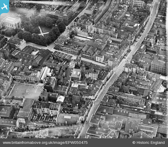
EPW050475 ENGLAND (1936). Milk Street and environs, Bristol, 1936
© Copyright OpenStreetMap contributors and licensed by the OpenStreetMap Foundation. 2026. Cartography is licensed as CC BY-SA.
Nearby Images (7)
EPW050475

EPW050472

EPW050474

EPW050473

EPW050471

EPW012229

EPW012228

Details
| Title | [EPW050475] Milk Street and environs, Bristol, 1936 |
| Reference | EPW050475 |
| Date | June-1936 |
| Link | |
| Place name | BRISTOL |
| Parish | |
| District | |
| Country | ENGLAND |
| Easting / Northing | 359229, 173521 |
| Longitude / Latitude | -2.5868990180341, 51.458707682709 |
| National Grid Reference | ST592735 |
