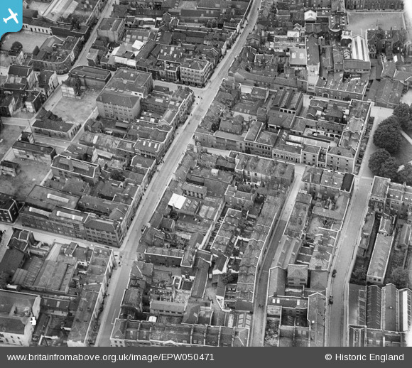
EPW050471 ENGLAND (1936). Milk Street and environs, Bristol, 1936
© Copyright OpenStreetMap contributors and licensed by the OpenStreetMap Foundation. 2026. Cartography is licensed as CC BY-SA.
Nearby Images (7)
EPW050471

EPW050474

EPW012229

EPW050475

EPW050472

EPW050473

EPW012228

Details
| Title | [EPW050471] Milk Street and environs, Bristol, 1936 |
| Reference | EPW050471 |
| Date | June-1936 |
| Link | |
| Place name | BRISTOL |
| Parish | |
| District | |
| Country | ENGLAND |
| Easting / Northing | 359340, 173531 |
| Longitude / Latitude | -2.5853024116628, 51.458805589981 |
| National Grid Reference | ST593735 |
Pins

Lidfam |
Monday 7th of December 2020 11:51:00 PM | |
|
Braikenridge |
Tuesday 22nd of December 2015 12:58:44 PM | |
|
Braikenridge |
Tuesday 22nd of December 2015 12:58:01 PM | |

Class31 |
Thursday 12th of December 2013 03:34:56 PM | |
|
Class31 |
Thursday 12th of December 2013 03:34:34 PM | |
|
Class31 |
Thursday 12th of December 2013 03:33:46 PM | |
|
Class31 |
Thursday 12th of December 2013 03:33:06 PM | |
|
Class31 |
Thursday 12th of December 2013 03:31:23 PM | |
|
Class31 |
Thursday 12th of December 2013 03:30:53 PM | |
|
Class31 |
Thursday 12th of December 2013 03:29:22 PM |