
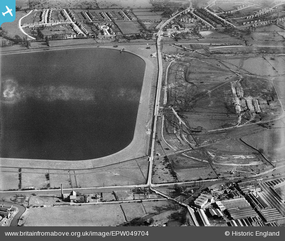
EPW049704 ENGLAND (1936). The site of the northern end of the William Girling Reservoir showing preliminary construction works, Ponders End, 1936
© Copyright OpenStreetMap contributors and licensed by the OpenStreetMap Foundation. 2026. Cartography is licensed as CC BY-SA.
Nearby Images (17)
EPW049704

EPW048904

EPW058455
 Reservoir under construction, Edmonton, 1938")
EPW056819

EPW060632

EPW058466
 Reservoir under construction, Edmonton, 1938")
EPW048902

EPW049697

EPW056827

EPW060637

EPW056328

EPW055986

EPW053839
 Reservoir under construction, Edmonton, 1937")
EPW049713

EPW050860

EPW052275

EPW048906

Details
| Title | [EPW049704] The site of the northern end of the William Girling Reservoir showing preliminary construction works, Ponders End, 1936 |
| Reference | EPW049704 |
| Date | March-1936 |
| Link | |
| Place name | PONDERS END |
| Parish | |
| District | |
| Country | ENGLAND |
| Easting / Northing | 536767, 195341 |
| Longitude / Latitude | -0.02332548825702, 51.639753214434 |
| National Grid Reference | TQ368953 |
Pins
Be the first to add a comment to this image!