
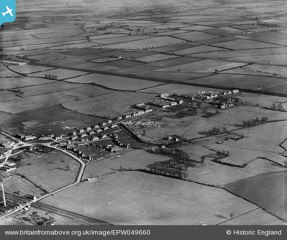
EPW049660 ENGLAND (1936). The village, Stewartby, 1936
© Copyright OpenStreetMap contributors and licensed by the OpenStreetMap Foundation. 2026. Cartography is licensed as CC BY-SA.
Nearby Images (16)
EPW049660

EPW049651

EPW049661

EPW054967A

EPW049650

EPW054979

EPW049655

EPW054970

EPW054968A

EAW045821

EPW049657

EPW049659

EPW049656

EPW049654

EPW049658

EAW045604

Details
| Title | [EPW049660] The village, Stewartby, 1936 |
| Reference | EPW049660 |
| Date | February-1936 |
| Link | |
| Place name | STEWARTBY |
| Parish | STEWARTBY |
| District | |
| Country | ENGLAND |
| Easting / Northing | 502241, 242216 |
| Longitude / Latitude | -0.50824336636486, 52.068447985174 |
| National Grid Reference | TL022422 |
