
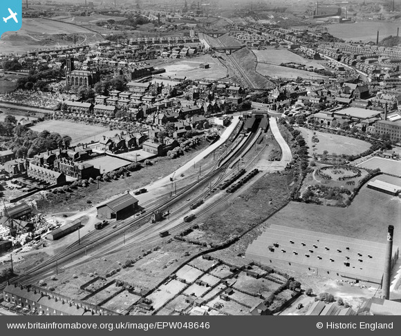
EPW048646 ENGLAND (1935). The goods yard, railway station and environs, Whitefield, from the south-east, 1935
© Copyright OpenStreetMap contributors and licensed by the OpenStreetMap Foundation. 2026. Cartography is licensed as CC BY-SA.
Nearby Images (12)
EPW048646

EPW046170

EPW047501

EPW047498

EPW048632

EPW048635

EPW047499

EPW048644

EPW048656

EPW048658

EPW047500

EAW039832

Details
| Title | [EPW048646] The goods yard, railway station and environs, Whitefield, from the south-east, 1935 |
| Reference | EPW048646 |
| Date | July-1935 |
| Link | |
| Place name | WHITEFIELD |
| Parish | |
| District | |
| Country | ENGLAND |
| Easting / Northing | 380779, 405956 |
| Longitude / Latitude | -2.2901347292128, 53.549641104789 |
| National Grid Reference | SD808060 |
Pins

Paul Williams |
Wednesday 24th of December 2025 12:29:43 PM | |
|
Paul Williams |
Wednesday 24th of December 2025 12:29:21 PM | |
|
Paul Williams |
Wednesday 24th of December 2025 12:28:58 PM | |
|
Paul Williams |
Wednesday 24th of December 2025 12:28:23 PM | |
|
Paul Williams |
Wednesday 24th of December 2025 12:27:59 PM | |
|
Paul |
Monday 17th of April 2023 05:58:48 PM | |
|
Paul |
Monday 17th of April 2023 05:58:07 PM | |
|
mr j kerwin |
Saturday 15th of August 2015 04:07:00 PM | |
|
mr j kerwin |
Saturday 15th of August 2015 04:05:30 PM | |
|
John Wass |
Saturday 2nd of May 2015 11:45:57 AM |