
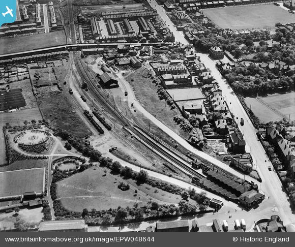
EPW048644 ENGLAND (1935). The goods yard, railway station and environs, Whitefield, 1935
© Copyright OpenStreetMap contributors and licensed by the OpenStreetMap Foundation. 2026. Cartography is licensed as CC BY-SA.
Nearby Images (12)
EPW048644

EPW048658

EPW048656

EPW047499

EPW047500

EPW048635

EPW047498

EPW048632

EPW047501

EPW048646

EPW046170

EPW046171

Details
| Title | [EPW048644] The goods yard, railway station and environs, Whitefield, 1935 |
| Reference | EPW048644 |
| Date | July-1935 |
| Link | |
| Place name | WHITEFIELD |
| Parish | |
| District | |
| Country | ENGLAND |
| Easting / Northing | 380628, 405994 |
| Longitude / Latitude | -2.2924163472392, 53.549977146403 |
| National Grid Reference | SD806060 |
Pins

John Wass |
Sunday 3rd of May 2015 12:57:30 PM |