
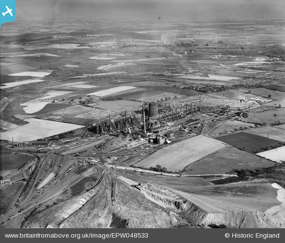
EPW048533 ENGLAND (1935). The John Lysaght Normanby Park Steel Works, Scunthorpe, from the north-west, 1935
© Copyright OpenStreetMap contributors and licensed by the OpenStreetMap Foundation. 2026. Cartography is licensed as CC BY-SA.
Nearby Images (20)
EPW048533

EAW009628

EAW023927

EAW049669

EAW028562

EAW009634

EAW041864

EAW027177

EAW023931

EAW041860

EAW019674

EAW049674

EAW034806

EAW019671

EAW027180

EAW019670

EAW041827

EAW041859

EAW009636

EAW031194

Details
| Title | [EPW048533] The John Lysaght Normanby Park Steel Works, Scunthorpe, from the north-west, 1935 |
| Reference | EPW048533 |
| Date | July-1935 |
| Link | |
| Place name | SCUNTHORPE |
| Parish | |
| District | |
| Country | ENGLAND |
| Easting / Northing | 488351, 414121 |
| Longitude / Latitude | -0.66424795506537, 53.615937203233 |
| National Grid Reference | SE884141 |
