
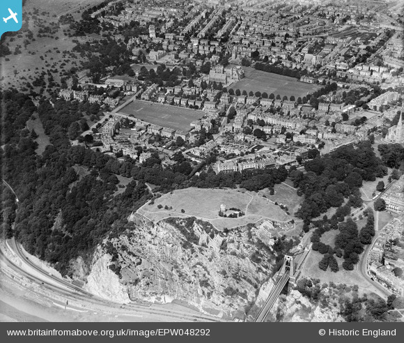
EPW048292 ENGLAND (1935). The Clifton Observatory, Observatory Hill and the surrounding residential area, Clifton, 1935
© Copyright OpenStreetMap contributors and licensed by the OpenStreetMap Foundation. 2026. Cartography is licensed as CC BY-SA.
Nearby Images (16)
EPW048292

EPW048298

EPW048295

EPW048291

EPW048294

EPW048293

EPW048290

EPW048299

EPW049535

EPW048297

EPW048296

EPW049533

EPW048300

EAW033327

EPW012024

EAW033323

Details
| Title | [EPW048292] The Clifton Observatory, Observatory Hill and the surrounding residential area, Clifton, 1935 |
| Reference | EPW048292 |
| Date | July-1935 |
| Link | |
| Place name | CLIFTON |
| Parish | |
| District | |
| Country | ENGLAND |
| Easting / Northing | 356688, 173476 |
| Longitude / Latitude | -2.6234689692743, 51.458114267103 |
| National Grid Reference | ST567735 |
Pins

Class31 |
Tuesday 1st of October 2013 09:50:35 AM |
