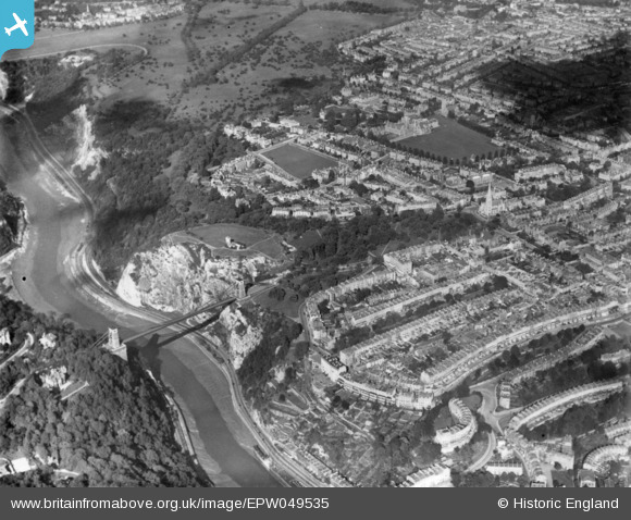
EPW049535 ENGLAND (1935). The Clifton Suspension Bridge, Observatory Hill and environs, Clifton, 1935. This image has been produced from a print.
© Copyright OpenStreetMap contributors and licensed by the OpenStreetMap Foundation. 2026. Cartography is licensed as CC BY-SA.
Nearby Images (13)
Details
| Title | [EPW049535] The Clifton Suspension Bridge, Observatory Hill and environs, Clifton, 1935. This image has been produced from a print. |
| Reference | EPW049535 |
| Date | December-1935 |
| Link | |
| Place name | CLIFTON |
| Parish | |
| District | |
| Country | ENGLAND |
| Easting / Northing | 356700, 173270 |
| Longitude / Latitude | -2.623271013065, 51.456262825106 |
| National Grid Reference | ST567733 |
Pins
Be the first to add a comment to this image!


![[EPW049535] The Clifton Suspension Bridge, Observatory Hill and environs, Clifton, 1935. This image has been produced from a print.](http://britainfromabove.org.uk/sites/all/libraries/aerofilms-images/public/100x100/EPW/049/EPW049535.jpg)
![[EPW048299] The Clifton Suspension Bridge, Observatory Hill and the suburb of Clifton, Clifton, from the south-west, 1935](http://britainfromabove.org.uk/sites/all/libraries/aerofilms-images/public/100x100/EPW/048/EPW048299.jpg)
![[EPW032526] The Clifton Suspension Bridge, Observatory Hill and the city, Bristol, from the south-west, 1930](http://britainfromabove.org.uk/sites/all/libraries/aerofilms-images/public/100x100/EPW/032/EPW032526.jpg)
![[EPW048295] The suburb of Clifton alongside Clifton Down, Clifton, from the south, 1935](http://britainfromabove.org.uk/sites/all/libraries/aerofilms-images/public/100x100/EPW/048/EPW048295.jpg)
![[EAW015138] The Clifton Suspension Bridge and Observatory Hill, Clifton, 1948](http://britainfromabove.org.uk/sites/all/libraries/aerofilms-images/public/100x100/EAW/015/EAW015138.jpg)
![[EAW033327] Clifton Suspension Bridge, Observatory Hill and the city, Clifton, 1950](http://britainfromabove.org.uk/sites/all/libraries/aerofilms-images/public/100x100/EAW/033/EAW033327.jpg)
![[EPW041480] The Clifton Suspension Bridge, Clifton Down promontory fort and environs, Clifton, 1933](http://britainfromabove.org.uk/sites/all/libraries/aerofilms-images/public/100x100/EPW/041/EPW041480.jpg)
![[EPW037150] The Clifton Suspension Bridge, Observatory Hill and environs, Clifton, 1931](http://britainfromabove.org.uk/sites/all/libraries/aerofilms-images/public/100x100/EPW/037/EPW037150.jpg)
![[EPW048292] The Clifton Observatory, Observatory Hill and the surrounding residential area, Clifton, 1935](http://britainfromabove.org.uk/sites/all/libraries/aerofilms-images/public/100x100/EPW/048/EPW048292.jpg)
![[EPW012024] Clifton Suspension Bridge and the Observatory, Clifton, 1924. This image has been produced from a print.](http://britainfromabove.org.uk/sites/all/libraries/aerofilms-images/public/100x100/EPW/012/EPW012024.jpg)
![[EAW033323] Clifton Suspension Bridge and Observatory Hill, Clifton, from the south-west, 1950](http://britainfromabove.org.uk/sites/all/libraries/aerofilms-images/public/100x100/EAW/033/EAW033323.jpg)
![[EPW001274] The Clifton Suspension Bridge, Bristol, 1920](http://britainfromabove.org.uk/sites/all/libraries/aerofilms-images/public/100x100/EPW/001/EPW001274.jpg)
![[EAW050560] The Clifton Suspension Bridge, Clifton, 1953](http://britainfromabove.org.uk/sites/all/libraries/aerofilms-images/public/100x100/EAW/050/EAW050560.jpg)